Land Use Classification with mUnet by Abhishek and Sayon
We aimed at developing a deep learning Pipeline to classify land use types from satellite images.
Land Use can be classified into following classes-
- Buildings
- Trees
- Crops
- Roads & Tracks
- Water
- Empty Fields
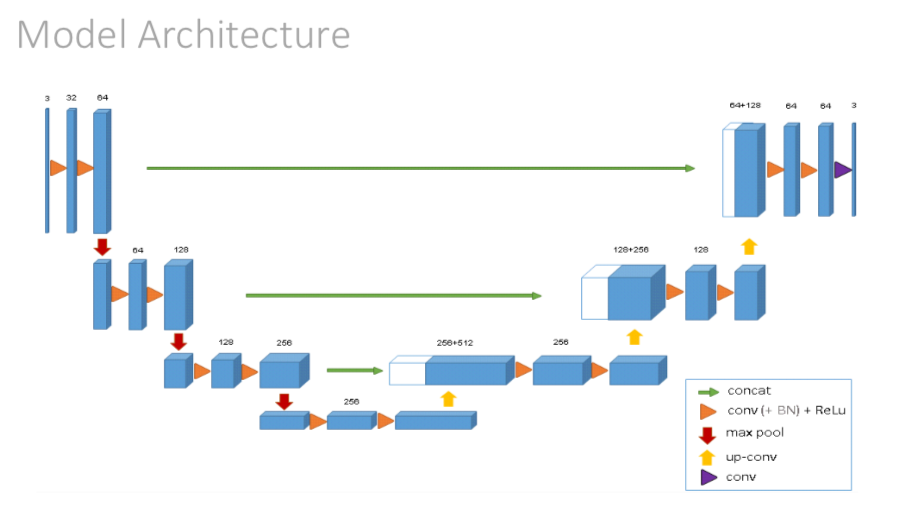
We used the paper by Lakshya Garg et al to implement their proposed Modified UNet Architecture for Land Use Classification of Satellite Imagery


Model was trained on Colab's 12GB NVIDIA Tesla K80 GPU for 150 epochs
with training accuracy of 80.037%

| Model | $Parameters | Accuracy |
|---|---|---|
| AlexNet | 61,000,000 | 78.234% |
| UNet | 31,379,205 | 62.1077% |
| mUnet | 31,105,669 | 80.897% |